The Wrong Place for a Suburban Drugstore

This is going to be a longer post. But I think it’s worth reading as I’m going to cover a whole bunch of issues that the proposed CVS at the corner of North Greensboro and West Weaver streets raises.

The Project Proposal

Before the Carrboro Board of Aldermen for their consideration on Tuesday night is a proposal to build a free-standing CVS drugstore at the corner of N Greensboro and Weaver Streets (public Hearing B1 on the Agenda).  The project’s principal flaw is not its corporate ownership, nor its architectural features or design- but its site plan that takes a corner lot facing two of our most important streets in a limited urban street grid, and places most of that land into a suburban parking format, thereby significantly destroying the value-creation properties of that land in the long term.

The rest of this post explores this flaw in detail.

UPDATE 11:45 pm on 2/25/2013: Per a request via Twitter, I have marked up the site plan for the proposed CVS to help illustrate points discussed in the rest of this post. Click to embiggen.

CVS Siteplan Markup

CVS Siteplan Markup

Notes on the site plan markup:

  • Red indicates where Carrboro “A Streets” are fronted with parking rather than urban buildings that embrace the pedestrian and the sidewalk.
  • Orange indicates where Carrboro “B Streets” are fronted with parking rather than urban buildings
  • Purple indicates where a Carrboro B Street, in this case, Center St, is fronted by a “pocket park” that may or may not be supportive of defensible space principles for urban public spaces

Original post continues below.

Carrboro Has Only Five Critical “A” Streets

When you look at a map of Carrboro, and focus on downtown, one of the things you’ll notice is that we have a pretty limited street network to work with.  Other communities like Asheville and Durham have large downtown street grids, many blocks deep in multiple directions, but Carrboro does not.

In urban retail districts, some retail analysts talk about “A” streets and “B” streets, with the “A” streets being home to most of the retail and key walkable urban facilities, while the “B” streets have fewer consumer-oriented businesses, more business-to-business workplaces, more residential development, and less activity overall. This is not to say that “B” streets are lesser places than “A” streets, but to clarify the different roles that streets play in an urban neighborhood.

Carrboro’s “A” Streets are:

  • Main St
  • Weaver St
  • Greensboro St
  • Jones Ferry Rd
  • Rosemary St


Carrboro "A" Streets - Downtown

Carrboro “A” Streets – Downtown

There are some other streets that have the potential to one day fulfill “A” street functions that are clearly not such streets today, but I think it’s hard to argue with this list.

Building a thriving local economy in Carrboro for the long term will require careful stewardship of a high-quality ***URBAN*** public realm along these streets, and of how they relate and connect to other streets and public spaces around them.

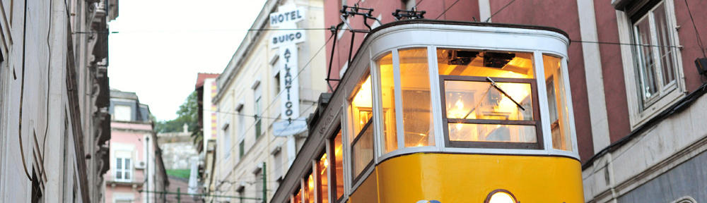
The CVS project greets several street frontages with parking rather than buildings.  This is a suburban practice, and this site is not a suburban location. The animated GIF below by David Sucher gets it right.  Please watch it change a few times. We should not be fronting West Weaver Street with parking spaces, nor North Greensboro Street.

Urbanism Starts with the Location of the Parking Lot by David Sucher, Author of City Comforts

Urbanism Starts with the Location of the Parking Lot by David Sucher, Author of City Comforts


CVS knows how to do this.  I’ve seen them do it in other cities, in old buildings and new buildings.  The examples below I believe are in Boston Brookline, MA and the DC area, respectively.


CVS Goes Urban - Old Building

CVS Goes Urban – Old Building


CVS Goes Urban - New Building

CVS Goes Urban – New Building


This Corner is Too Important to Get Wrong, and this Project is Too Small

In 2010, the town of Chapel Hill asked former Raleigh Urban Design Center guru Dan Douglas and his firm, Kling Stubbins- to take a look at their downtown and help them identify strategic redevelopment opportunities going forward.  Like Carrboro, Chapel Hill’s downtown is mostly an East-West affair that is only two streets deep.

One of the most interesting findings of the Kling Stubbins report is that corner properties on Franklin Street command the highest property values per square foot. This is the local real estate market telling the community these corners were the most important locations in downtown Chapel Hill, or at least the best ones on which to locate a business.

If we look at corners in Carrboro, it stands to reason that corners where two or more “A” Streets meet will be rather important. Those corners are:

  1. E. Main / Rosemary
  2. E. Main / N Greensboro,
  3. E Weaver / E Main / Roberson
  4. W Main /  Jones Ferry Rd
  5. W. Weaver / N Greensboro

And that’s all. If these intersections are likely to produce our highest-value corners in our urban core, we should build a significant amount of stuff on them.  We should not leave them mostly as parking.  As a community, we should be aiming to create more public and private value on these corners. Any project on the properties proposed for development here should be much, much bigger in terms of total gross square footage built.

I will add that I expect there to be some other voices in the discussion saying this project should not be approved because it is “too big.” I preemptively reject the notion that it is possible to take the average of my “too small” comments next to those and suggest that the amount of square footage is somehow “just right.”

It is quite possible to conceive of a mix of uses for this corner dominated by office and housing, with a modest amount of retail – that would add significant square footage to downtown (beyond what CVS is proposing) while not adding as many trips to this corner as a 24-hour drugstore.  Any residents living in this location will have a tremendous ability to substitute car trips with walking, bicycle and transit trips, and office-generated trips would be very susceptible to being diverted to the same three environmentally friendly modes.

The sketch plans created for these parcels from the 2001 “Crossroads Conversation” conducted by The Village Project show some concepts that are more representative of the types of buildings that belong on such an important corner in our town. The CVS proposal is not in the character of the type of project intensity that belongs on one of our biggest redevelopment opportunities on one of our top 5 intersections.

Crossroads Charette Design 1

Crossroads Charette Design 1


Crossroads Charette Design 2

Crossroads Charette Design 2

This Corner is Right In the Middle of Our Urban Grid and Walkable Core

Over the course of the past week on this blog, I’ve discussed what it means to be “urban” and my #InformalUrbanIndicators series of blog posts focused on several phenomena present in Carrboro’s downtown that indicate that our town, unlike so many others of its size, has a living, breathing, vibrant urban heart.

In documenting several of those #InformalUrbanIndicators, I made maps showing the parts of town covered by individual indicators if you created polygons from the most outlying instances of each indicator.  Below, in one map, you will find a combined overlay of my maps for Graffiti, Holiday Lighting Displays, Food Trucks, Outdoor Dining, and Yarn Bombing.

View Combined Coverages in a larger map

If any of these indicators alone is a signal to where people are most likely to walk, then any place where they overlap is surely an even more likely place people will walk.  As you can see, the proposed CVS project (using the blue marker) is in one of the most walking-friendly places in downtown.  This is inherently a bad place for a auto-oriented development project, with lots of parking fronting A Street sidewalks, not to mention other streets as well.

Why Too Much Parking Is a Really Big Deal

As David Sucher’s graphic above shows that urbanism begins with the placement of the parking lot, such a large amount of parking on this site has actively negative effects that go beyond the lost development opportunity that locking this land up as parking represents.

While I’ll elaborate more on this in another post, there is a finite limit to the amount of economic development that downtown Carrboro can support as long as it is predicated on being served by FREE parking.  Eventually, the town will reach a point where bringing people in to park for free will over-congest the streets during key shopping times and the hassle of getting downtown in your car to park for free will become a deterrent to economic growth. We are not quite bumping into that limit yet, but we will reach it sooner rather than later.

I personally question the necessity or wisdom of adding this much parking to any key site in downtown, when the town already has a significant amount of parking that could be managed more effectively, and a significant set of assets in transit, bicycle, and walking infrastructure that also provide access to downtown.

That said, if we are going to add this much parking, it should be in a deck, and it should be tied to a much larger building program that allows for shared parking across several uses.

So What Now?

Surely we as a community could have done more over the past ten years to plan for this site so that we would not get proposals like this. Alas, we did not, and we now have a proposal for a use and a site plan that attempts to suburbanize one of our critical urban crossroads in Carrboro. That being the case, I encourage the Board of Aldermen to vote against approving this project on Tuesday evening.

But voting to deny the construction of this project is only the first step that needs to be taken. If you visit the county website and use the ARIES real estate search tool, you will find that the land value for the corner in question is over $520,000 and the building value is only $130,334, on 0.33 acres.  This land valuation greatly exceeding the building value suggests that if CVS is turned down, it is only a matter of time before another proposal for this corner appears.

It’s important for the community to start planning for what we DO want to happen in locations like this one.

Informal Urbanism Indicator #6: Food Trucks

Food Truck Mini-Rodeo at Johnny's

Food Truck Mini-Rodeo at Johnny’s

Perhaps the most high-profile Informal Urban Indicator that can be spotted around Carrboro, Durham, and many other cities is the Food Truck. Whether committed to a regular spot or broadcasting its movements on Twitter, the repeated presence of one or more food trucks in a certain place is usually hinting at one thing: “this part of town could absorb more dining and perhaps more retail options.” If the place where the repeat appearances occur is single-use and does not include food service as part of its by-right zoning, the food trucks provide a hint on where mixed-use is warranted, and in some cases, desperately needed. (there’s a reason why whenever RTP hosts a food truck rodeo at their HQ, lines for lunch are 30 minutes long or longer)

Food trucks are particularly interesting as urban indicators because of their ability to relocate in response to demand for their food, albeit within constraints imposed by town operating rules. To my knowledge, Carrboro’s rules are rather simple and require that the food truck has a permit to operate in Carrboro, that it can park in any lots specified on a map maintained by the town, and pay $75 to be a vendor.

Below are some additional photographs I have taken of the Carrboro food truck scene over the last few years. At the end of the post, you can see a map of where food trucks are commonly found in town, and the coverage area bound by those locations.

section_break

Fitch Lumber Taco Truck

Fitch Lumber Taco Truck

Crepe Truck at Fifth Season Parking Lot

Crepe Truck at Fifth Season Parking Lot

Ice Cream Truck at Seagrove Pottery

Ice Cream Truck at Seagrove Pottery

Evening Benefit Food Truck Rodeo at Farmers' Market

Evening Benefit Food Truck Rodeo at Farmers’ Market


section_break

Below is a map of regular food truck locations in Carrboro. Zoom out slightly for a full view. View Carrboro Food Truck Locations in a larger map #informalurbanindicators

Informal Urbanism Indicator #5: Outdoor Dining

One of the key features that differentiates an urban place from more suburban places is the number of people on the streets. While many of the people out and about are walking from one place to another, many of them are quite stationary, often at a table enjoying food and drink. In his masterpiece on cities and towns, A Pattern Language, Christopher Alexander states:

“We know that people enjoy mixing in public, in parks, squares, along promenades and avenues, in street cafes. The preconditions seem to be: the setting gives you the right to be there, by custom; there are a few things to do that are part of the scene, almost ritual: reading the newspaper, strolling, nursing a beer, playing catch; and people feel safe enough to relax, nod at each other, perhaps even meet.”

Outdoor Dining - Milltown

Outdoor Dining – Milltown

Alexander is observing what we all know- people like to be around other people, and cafe culture is perhaps human civilization’s best invention for providing people-watching opportunities.  But although there are plenty of people-watching opportunities inside any eating or drinking establishment, the deliberate move to provide outdoor seating, which always introduces extra labor hassles to the establishment, is a recognition that there are people-watching opportunities outside along the street as well as in the cafes, bars, and restaurants themselves.

That being the case, if we are searching for indicators of where people walk, outdoor dining/cafe seating should be a good guide.  And boy, does Carrboro have a lot of outdoor dining.  The least expected place? Burger King!  Yes, it’s a very suburban setup at Willow Creek shopping center, and your view is mostly people parking nearby, but even BK put out a few tables and a shrubbery. Good for them.

Outdoor Dining- Burger King

Outdoor Dining- Burger King


Here are some tables along West Main Street at Tres Amigos.

Outdoor Dining - Tres Amigos

Outdoor Dining – Tres Amigos

Including these three locations, even if we ignore food trucks that might have their own seating (i.e. Fitch Lumber taco truck), I found a total of 17 Outdoor Dining locations in Carrboro. Here they are on a map, each identified with a burger and beverage icon:


View Outdoor Dining in a larger map

While I was not surprised, it is worth noting that there is no Outdoor Dining at Carrboro Plaza.  Most of the rest of the town that has any commercial development has found some space for Outdoor Dining. If you’ve been following the blog this week, you’re probably starting to see a pattern in the maps, which I will cover in an upcoming post.

#informalurbanindicators

Informal Urbanism Indicator #4: Yarn Bombing

Whereas the Super Strudel graffiti was likely the work of one artist, the February 2012 Yarn Bombing of downtown Carrboro was a coordinated work of many skilled artists who sought (and received) permission from the town of Carrboro to put their pieces in the public realm. Below are some photos of some of the Yarn-bombed sites, and a map of where they were ultimately located, which reflects the combined decisions of town representatives and artists.

Yarn Bombed Tree, Looking Glass Cafe

Yarn Bombed Tree, Looking Glass Cafe

Yarn-Bombed Parking Lot

Yarn-Bombed Parking Lot (Photo by Flickr User RubyJi)

Yarn-Bombed Town Hall

Yarn-Bombed Town Hall (Photo Courtesy Carrboro Citizen)


View Yarn Bombing in Carrboro in a larger map

#informalurbanindicators

Informal Urbanism Indicator #3: Municipal Holiday Light Displays

Snowflake Above WSM Lawn

Snowflake Above WSM Lawn

With Christmas 2012 quickly receding into memory, here’s an indicator that you need to measure while you can: holiday light displays put up by the town! Our earlier indicators from this week, Graffiti and Fliers, reveal mental maps of walkable space of a single individual and many individuals acting separately.

Community holiday lights on telephone poles or buildings reveal what is probably a resource-constrained consensus decision made by several individuals together in our public works department, perhaps in consultation with the Town Manager.

This one was rather easy to map- I just got in the car and drove all over town in any direction I saw a snowflake until I passed the last lighted pole.  If I continued east into Chapel Hill I would have more data, but I had somewhere to be and went home after observing the extent of holiday snowflakes in Carrboro.

In the map below, the roads marked in red are where the snowflakes were posted, and the green area is the overall zone of coverage they surrounded using the furthest extent of snowflakes in each direction.

Holiday Snowflake Extent, Carrboro 2012

Holiday Snowflake Extent, Carrboro 2012

#informalurbanindicators

Informal Urbanism Indicator #2: Fliers

Fliers in Carrboro

Fliers in Carrboro

If you’re trying to determine where the hotspots of the urban fabric begin and end in a neighborhood, you would be hard pressed to find a better indicator than fliers on telephone poles, walls, and other surfaces.  Fliers are great indicators for the following reasons:

1. They’re usually time-limited.  The constant refreshing of flier locations re-validates that these locations are important to pedestrians.

2. They can be layered on top of each other.  Some flier locations develop a 2-to-5 flier thick coat of promotional verbiage and graphics.  Like the rings on a tree stump where more rings equals more years, more fliers stapled on top of each other indicates a stronger advertising location.

With the second quality of flier placement, we can actually gather data on flier density in addition to flier locations.  I’ve started using a smartphone app called Fulcrum to gather data on fliers, including flier density, and although it will take a while to get a data set like the one for the Super Strudel post, I do intend to map it and try some analytical techniques on the data if it makes sense.

The key point that is great about fliers, however, is that whenever you see repeated postings of new fliers from different people and organizations at the same place, you’re looking at a place that is important across MANY people’s mental maps of their community, and most likely within the heart of the walkable urban fabric.

#informalurbanindicators

Informal Urbanism Indicator #1: Graffiti. Where Does The Urban Fabric Begin and End? Ask Super Strudel

If a visitor asks a random Carrboro resident where downtown is, they’ll be almost certain to get directions to where the railroad tracks cross Main Street right by The Station bar.

This is the undisputed center of Carrboro’s urban fabric, a.k.a. the place where the most people are walking around. But if this is the center of the action, where is the edge of the action? Where does it dissipate? When you are in downtown Carrboro or any other downtown, do you ever wonder how far the people you see walking walked to get there?

As someone who does a lot of walking around town, I’ve started thinking about all the little and big modifications that happen to an urban streetscape because one person or institution tries to capitalize on the presence of a significant number of walkers to sell a product, promote a show, or share an idea. For lack of a better term, I will call these modifications “Informal Urbanism Indicators.” Another way to think of them might be as “Hints from Residents.” In this case, the “hint” is data about where people walk.

For the remainder of the post, I’d like to introduce you to our urban graffiti guide, Super Strudel.  To be fair to the artist who created him, I must acknowledge that perhaps the “SS” stands for something else, and that it is possible that “Super Strudel” was added by another person walking by with a sharpie. I had seen Super Strudel in a few places and started taking pictures before I finally got his name down from this display by Fitch Lumber.

Super Strudel at Fitch Lumber

Super Strudel at Fitch Lumber


Whatever type of rodent he is, this guy gets out on the town pretty regularly.  He showed up over on the dumpster at Carrburritos:

Super Strudel on Carrburritos' Dumpster

Super Strudel on Carrburritos’ Dumpster

Over by the White Oak Condominiums on Fidelity Street:

Super Strudel at White Oak

Super Strudel at White Oak

On the edge of the UNC Campus across from the Carolina Inn:

Super Strudel Visits Campus

Super Strudel Visits Campus

When he arrived at Back Alley Bikes and Tar Heel Tattoo, he went large format:

Super Strudel Seeks Bikes, Tattoos

Super Strudel Seeks Bikes, Tattoos

While this final shot on the back of Kinetix does not convey the size well, this one was also 4 or 5 feet tall, I think:

Super Strudel at Carolina Fitness

Super Strudel at Kinetix

The interesting thing about these photos as a group is that if we map them, we get a visual that depicts (probably in part) the mental map of one person of what constitutes the walkable urban fabric of downtown Carrboro and Chapel Hill.  Click on the minus button in the map to zoom out one level, and you’ll see all 6 photo locations above mapped.


View Super Strudel Art Locations in a larger map

But this is just one map of one person’s urban fabric, using one variable.  If we layer together data created by MULTIPLE people, that represent jointly made decisions or separately made decisions that reinforce each other, we get more “Hints From Residents.” As the title of the post suggests, I’m going to do several of these posts on Informal Urban Indicators. The post on Indicator #2 shows up tomorrow- feel free to guess what’s coming in the comments. Meanwhile, let me know if I missed any Super Strudel locations! I wouldn’t be surprised if I did.

#informalurbanindicators