Five Great Reasons to Bulldoze the BCBSNC Building In Chapel Hill

Former BCBSNC Headquarters

BCBSNC Headquarters – A Building Its Own Architect Doesn’t Know What Do To With (photo from newsobserver.com)

Today Blue Cross Blue Shield of NC announced they are consolidating their operations in Durham and vacating their dated, modernist solar-cooker-on-cinder-blocks digs in Chapel Hill, because the building is inflexible, expensive to operate, and bad for workers:

Blue Cross officials said the insurer’s distinctive Chapel Hill headquarters – a rhomboid, glass structure designed by the architect A.G. Odell Jr.’s firm – had become more costly to operate than its other buildings and didn’t fit the way employees work today.

The article adds:

Blue Cross expects the move to Durham will ultimately save it more than $2.5 million annually in utilities and operating costs.

“It will be a walkable, flexible environment, and create a community of literally all of our employees,” Borman said.

As for the Chapel Hill headquarters, Blue Cross plans to work with town officials to determine the property’s future, Borman said.

McMurray [the building’s designer] worries what will become of his building.

“It’s sad that they’re leaving it,” he said. “I don’t know what you do with it.”

I visited this building this past year on a day with temperatures in the 60s to low 70s.  The air conditioning was cranked up like it was in the high 80s or 90s outside, which I assume is part of the reason why their utility costs are so high- whoever occupies the building must combat massive solar gain through the roof.  Even the guy who built the building can’t think of a reason to keep using it.

The site layout is as flawed as the building, with curvilinear roads in a mid-century suburban layout that wastes space with both pavement and grass.  But as much as anyone hates the announcement that a major employer is leaving, the silver lining is an opportunity to redevelop over 30 acres, or more than 1.5 million square feet of land. If this dysfunctional building was torn down, what could fit there instead?

For inspiration, here are five other examples of quality urban development that could fit in that area or less:

1. Cesky Krumlov, Czech Republic (photo by Flickr user Iurbi)

This picture perfect town is mostly enclosed by a bend in the river that winds through it.  The area within the river bend is about 80% of the size of the BCSBNC site.

Cesky Krumlov, Czech Republic

Cesky Krumlov, Czech Republic

2. Vernazza, Italy (photo by Flickr user damianocerrone)

Hemmed in by the see and a hill, Vernazza only takes up about 40% of the BCBSNC site, and that includes some of the harbor.

Vernazza, Italy

Vernazza, Italy

3. Downtown Shelburne Falls, MA (photo by Flickr user neonlike)

Picturesque small town in Massachusetts with a waterfall, an abandoned bridge covered with flowers, and a trolley museum – in about 25% of the BCBSNC site.

Shelburne Falls, MA

Shelburne Falls, MA

4. The entire pedestrian-only section of Church St and the 8 surrounding blocks in Burlington, VT. (photo by Flickr user devils4ever)

About 91% of the size of the BCBSNC site.

Church St, Burlington, VT

Church St, Burlington, VT

5. The Downtown Core of Black Mountain, NC (photo by Flickr user Bass Player Keith Hall)

East of Asheville, the downtown of Black Mountain is about 50% the size of the BCBSNC site.

Downtown Black Mountain, NC

Downtown Black Mountain, NC

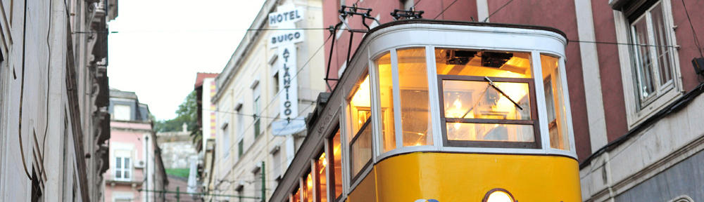
6. And One Bonus Location: East Franklin St (photo by Flickr user Zannie Gunn)

The space bound by Columbia St, Franklin, Rosemary, and Henderson takes up about 25% of the BCBSNC site.

East Franklin St

East Franklin St

Any of these building patterns are more resilient for changing times than the modernist design of the BCBSNC building, which was always more about making abstract aesthetic statements than being useful to the people using the building or embracing the neighboring parcels in a constructive way.  When was the last time you heard someone say Franklin St “doesn’t support the way people work or live today?”

Build a street grid on this site and populate it with many smaller buildings, public spaces, and much less parking, and Chapel Hill can have a tremendous new urban neighborhood built to last. This is an exciting opportunity. What could you imagine here?

Measuring Transit Access to Potential Southern Orange County Library Sites

When considering where to site a public library in Southern Orange County, one of the criteria studied by both town and county staff has been the presence of public transportation, in this case, Chapel Hill Transit bus service.  Evaluating this criteria has been conducted by noting the distance to the nearest bus stop in materials we have seen thus far.  However, transit service is not evenly distributed at every stop and different bus stops provide different levels of access to the rest of the transit network at large.

Fortunately, there is a great tool called Mapnificent that allows you to calculate how far you can travel from a specific point on transit at a certain time of day.  This calculation is completed using the Google Transit data for a community that is publicly available.

Using Mapnificent, I created the following maps for the three county sites that the Carrboro Board of Aldermen sent to the Orange County Board of Commissioners, as well as two other sites that were previously mentioned by Carrboro elected officials: 201 S Greensboro St and 300 E Main St.  Here are the results.  The tool was set to see how many places could reach the library sites within a 15-minute bus ride at 9 am on a weekday.

The light-colored areas can reach the library site within 15 minutes by bus and walking.  The remainder of each map cannot.

1128 Hillsborough Rd – County’s Preferred Site as of March 2013

1128 Hillsborough Rd: 15-Minute Transit Shed

1128 Hillsborough Rd: 15-Minute Transit Shed

As you can see, the site has limited access to most Chapel Hill residents and the most heavily populated parts of Carrboro along Jones Ferry Rd and NC 54 are generally not included in the 15-minute travel zone to this library site.

401 Fidelity St

401 Fidelity St: 15-Minute Transit Shed

401 Fidelity St: 15-Minute Transit Shed

401 Fidelity St fares better, covering the major North-South and East-West roads in Chapel Hll, and getting down to part but not all of Southern Village.  Coverage is barely reaching Carrboro High School.

301 W Main St (Town Hall Site)

301 West Main St: 15-Minute Transit Shed

301 West Main St: 15-Minute Transit Shed

The Carrboro Town Hall site shows expanding coverage through more of Carrboro, as well as improved access to Glen Lennox and other neighborhoods near Eastwood Lake.

201 S Greensboro St (Roberson St Parking Lot Site)

201 South Greensboro St: 15-Minute Transit Shed

201 South Greensboro St: 15-Minute Transit Shed

Everywhere in Carrboro that has bus service can reach this site in less than 15 minutes by bus. In Chapel Hill, residents along Eubanks Rd and Ephesus Church Rd can reach the library in 15 minutes by bus.

300 E Main St

300 East Main St: 15-Minute Transit Shed

300 East Main St: 15-Minute Transit Shed

With 300 East Main’s super-central location, now even residents in Durham County have 15-minute or less access by bus to the library.  Luckily for us, if we put the library there, those Durham residents might spend some money with our merchants while they visit.

Obviously, there’s more that goes into library site selection than how easy it is to take the bus there.  But conversations I’ve had in Carrboro suggest that this is an important criteria for many people, not only for environmental and local economy reasons, but also for social justice ones- like making the library as easy to access as possible for households that may not own a car.

The level of transit service to the library cannot be judged simply by “is there or isn’t there a bus stop nearby?”  We also need to look at the amount of network you can reach from that stop, and (perhaps a topic for another post) the level of frequency and hours of service available throughout the day, evening, and weekends.

Informal Urbanism Indicator #1: Graffiti. Where Does The Urban Fabric Begin and End? Ask Super Strudel

If a visitor asks a random Carrboro resident where downtown is, they’ll be almost certain to get directions to where the railroad tracks cross Main Street right by The Station bar.

This is the undisputed center of Carrboro’s urban fabric, a.k.a. the place where the most people are walking around. But if this is the center of the action, where is the edge of the action? Where does it dissipate? When you are in downtown Carrboro or any other downtown, do you ever wonder how far the people you see walking walked to get there?

As someone who does a lot of walking around town, I’ve started thinking about all the little and big modifications that happen to an urban streetscape because one person or institution tries to capitalize on the presence of a significant number of walkers to sell a product, promote a show, or share an idea. For lack of a better term, I will call these modifications “Informal Urbanism Indicators.” Another way to think of them might be as “Hints from Residents.” In this case, the “hint” is data about where people walk.

For the remainder of the post, I’d like to introduce you to our urban graffiti guide, Super Strudel.  To be fair to the artist who created him, I must acknowledge that perhaps the “SS” stands for something else, and that it is possible that “Super Strudel” was added by another person walking by with a sharpie. I had seen Super Strudel in a few places and started taking pictures before I finally got his name down from this display by Fitch Lumber.

Super Strudel at Fitch Lumber

Super Strudel at Fitch Lumber


Whatever type of rodent he is, this guy gets out on the town pretty regularly.  He showed up over on the dumpster at Carrburritos:

Super Strudel on Carrburritos' Dumpster

Super Strudel on Carrburritos’ Dumpster

Over by the White Oak Condominiums on Fidelity Street:

Super Strudel at White Oak

Super Strudel at White Oak

On the edge of the UNC Campus across from the Carolina Inn:

Super Strudel Visits Campus

Super Strudel Visits Campus

When he arrived at Back Alley Bikes and Tar Heel Tattoo, he went large format:

Super Strudel Seeks Bikes, Tattoos

Super Strudel Seeks Bikes, Tattoos

While this final shot on the back of Kinetix does not convey the size well, this one was also 4 or 5 feet tall, I think:

Super Strudel at Carolina Fitness

Super Strudel at Kinetix

The interesting thing about these photos as a group is that if we map them, we get a visual that depicts (probably in part) the mental map of one person of what constitutes the walkable urban fabric of downtown Carrboro and Chapel Hill.  Click on the minus button in the map to zoom out one level, and you’ll see all 6 photo locations above mapped.


View Super Strudel Art Locations in a larger map

But this is just one map of one person’s urban fabric, using one variable.  If we layer together data created by MULTIPLE people, that represent jointly made decisions or separately made decisions that reinforce each other, we get more “Hints From Residents.” As the title of the post suggests, I’m going to do several of these posts on Informal Urban Indicators. The post on Indicator #2 shows up tomorrow- feel free to guess what’s coming in the comments. Meanwhile, let me know if I missed any Super Strudel locations! I wouldn’t be surprised if I did.

#informalurbanindicators

How are Carrboro Residents Distributed Across Town?

Recently, a programming guru at MIT, Brandon Martin-Anderson decided to make a map of every person in the US Census- all 300+ million of us. The map assigns a dot for every person to the Census Block they live in, and then displays it.  You can see the interactive map here, zoomed to a level that shows Hillsborough, Durham, Carrboro and Chapel Hill, mostly. Anderson has since added Canada and Mexico Census data as well.

Here’s a slightly more zoomed-in look at our neck of the woods. The main commercial section of Franklin Street is shown in blue.

Census Dotmap of Chapel Hill / Carrboro

Census Dotmap of Chapel Hill / Carrboro

If you look at the Chapel Hill / Carrboro map long enough, you’ll notice a few things:

  1. There’s a “core” of population density (circled in red) that includes the UNC campus, the MLK corridor about halfway between Foster’s Market and Estes Drive, West Carrboro’s apartment complexes along NC 54 and Smith Level Road, and Southern Village.
  2. The large white spaces in the center of both Chapel Hill and Carrboro are contiguous Census Blocks that are dominated by employment and not residents, so they appear to be empty. They simply have few or zero residents.  In 2020, projects like Greenbridge, 140 West, 300 East Main and Shelton Station should change these blocks a good deal.
  3. There are some other denser clusters of population near Eastowne/Sage Rd/Erwin Rd and at some apartment complexes on MLK near Timberlyne.
  4. Southern Village is clearly more dense than Meadowmont.
  5. Suburban Carrboro is generally a little more dense than suburban Chapel Hill.

If we further zoom in on Carrboro, and match the dots up to a street map, you can also see that the densest neighborhoods in town are Abbey Court/Collins Crossing condominiums, and generally the entire area bounded by Jones Ferry Rd, Barnes St, and NC 54; Estes Park Apts, the entire area bounded by NC 54 and Old Fayetteville Rd; and the apartment complexes along Smith Level Rd close to Carrboro High School.

Carrboro Density

Carrboro Density – click to embiggen